Inspire Challenge 2017 Proposal
Targeting sustainable intensification technologies with a hyper-local LandPKS tool
Potential impacts of sustainable intensification (SI) technologies are hindered by low adoption by farmers. Targeting efforts often fail to consider the fine-resolution biophysical and social drivers of SI technologies, nor do they take into account an active role by the user to adapt recommendations based on the hyper-local information.
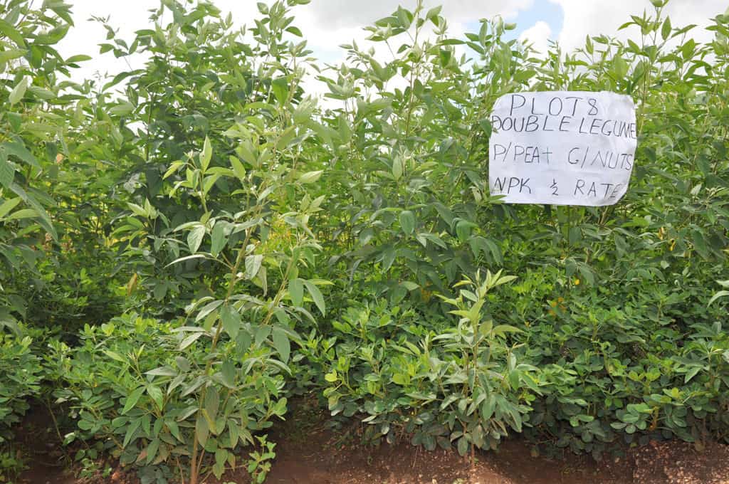
As illustrated in Malawi, localized knowledge of performance, soil types and biophysical niche has been key to promoting novel SI technologies, including pigeonpea and integrated nutrient management.
Spatial targeting supports both adoption and adaptation of these technologies. Generation of spatially-explicit hyper-local recommendation domains that can support decision-making at farm level is hindered by lack of reliable grid layers on soil properties that limit estimation of soil water dynamics which varies at small spatial scale.
An idea to solve this
We propose to create hyper-local recommendation domains for sustainable intensification (SI) technologies. This unique approach will integrate Land-Potential Knowledge System (LandPKS) point-based soil matching algorithms and a spatially-explicit model, with focus on utilizing remote-sensing data to localize and scale out SI findings from seven years of Africa RISING research in Malawi and Tanzania.
This tool will guide spatial targeting of SI technologies to provide ‘best fit’ options for risk reduction and enhancement of local adaptation of farmers within target geographies. We will populate a knowledgebase on soils, weather, and topography.
We will innovatively combine geospatial tools and datasets with point-based modeling of soil characteristics through LandPKS. Therefore, we hypothesize that:
- A hyper-local evaluation of soil conditions using a combination of user-based site characterization and algorithm-based matching to existing digital spatial databases significantly improves knowledge on site-specific biophysical parameters that influence soil nutrient and moisture dynamics.
- Integrating local site characteristics obtained through LandPKS tool and biophysical factors obtained by remote sensing platforms improves the delineation of reliable hyper-local recommendation domains for integrated SI technology options, thereby supporting decision making at the farm level.
The success of implementing hypotheses above is anchored on:
- Synergy: integrating standalone data and tools that have been developed by partners.
- Local knowledge: partners have amassed significant knowledge and data on SI technologies through farming systems research modeling, participatory research, thousands of on-farm experimentation plots and training of extension and farmers.
- Expertise: the team brings together multidisciplinary expertise required in a farming systems approach.
- Off-the-shelf tools: LandPKS mobile tool for site characterization and soil matching tool is operational. Spatially explicit RDs generated by Africa RISING are already utilized to guide scaling of SI technologies.
- Sustainability: partners have strong working relations with local government and non-governmental institutions that can continue development of the products when the project ends, including the African Fertilizer and Agribusiness Partnership.
The pilot project will be focused on testing integrated SI technologies in Tanzania and Malawi comprising of improved maize/legume germplasm, and organic and inorganic fertilizer management. The sequence of implementation:
- Site characterization using field methods and LandPKS tool for matching observed site characteristics with existing digital reference soil databases. Validate LandPKS soil matching results with field observations.
- Employ machine learning algorithms to generate and validate hyper-local recommendations for scaling out SI technology options based on site properties obtained from LandPKS soil matching algorithm, agronomic findings and remote sensing derived climate and topography data.
- Design and populate a cloud-based knowledge base for collating spatially referenced data on soils, weather, topography and site-specific recommendations for SI technology options.
- Design of a wireframe for a new LandPKS module which will provide evidence-based and actionable spatial information on the suitability of specific SI technology options to farmers, development organizations, and extension agencies.
Funding is required to support staff costs, LandPKS field testing and field supplies, travel expenses for project partners. Our experienced project team from highly reputable institutions will provide a significant leverage for required expertise and networks with local partners.
The essential data that will be generated from this pilot includes high spatial and temporal resolution satellite-derived data on climate, soil properties, topography and land use/cover, and hyper-local spatially explicit RDs for selected integrated SI technologies.
The predicted impact
This project will help in scaling up the delineation of spatially explicit recommendation domains for best-bet SI technologies at larger spatial extent. This will facilitate a contiguous workflow from the knowledge base to dissemination of evidence-based and actionable information on the suitability of particular SI technology options to farmers, development, and extension agencies.
Outputs from this project will provide the missing information that is urgently needed to develop a working approach that supports investment by grant agencies to test the recommendation domain options developed here.
In the near future we will be able to disseminate SI technologies through LandPKS to farmers in Tanzania and Malawi, however, this catalytic funding is needed to design necessary wireframe and knowledge base.
Support this Proposal
The Platform for Big Data in Agriculture is all about the creating connections to build the capacity’s need to inspire real change in the agriculture sector.
The aim of the Inspire Challenge is to generate innovative ideas that will revolutionize the future of agriculture using big data tools. You can be a part of the revolution by supporting these initiatives and help secure food for the future.
Contact one of the team members below to ask how you can help realize this idea.
Partners: