News Archives:

February 27, 2019
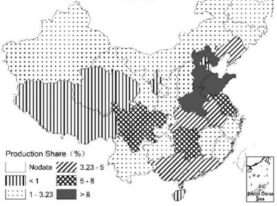
Chandrashekhar Biradar (ICARDA) co-authored a paper on the mapping of annual cropland in Central Asia. Published in the Remote Sensing journal, the study used a reference time-series-based mapping method (RBM) to create binary cropland vs. non-cropland maps using irregular Landsat time series.
February 26, 2019
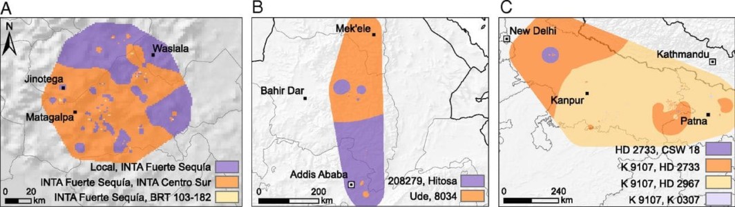
Through a farmer citizen science approach, researchers at Bioversity International successfully scaled on-farm crop trials in three countries and improved crop variety recommendations.
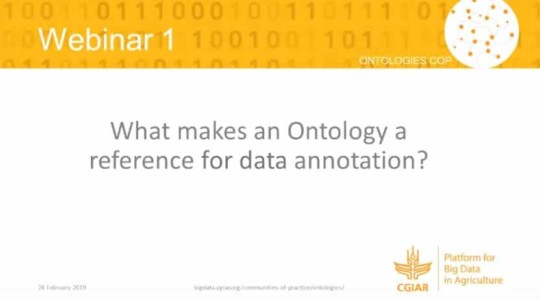
February 26, 2019
CGIAR Webinar by the Platform for Big Data in Agriculture’s Community of Practice on Ontologies – What makes an ontology a reference for data annotation?
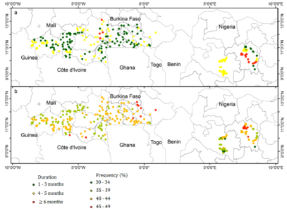
February 25, 2019
Combined with socioeconomic data, remote sensing-derived drought index can predict the occurrence of droughts and rice farmers’ mitigation measures.
February 24, 2019
Vegetable productions correlate with rural labor availability, urban population growth, and road density. No significant effects of climate factors were found.
February 22, 2019
A group of international scientists developed a new methodology to map global biodiversity richness using satellite-based remote sensing data.