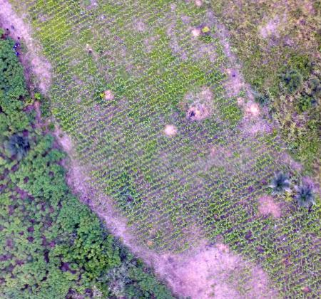
Remote sensing-based crop mapping in sub-Saharan Africa (SSA) is challenging due to the small field size, intercropping, different crop species with similar phenologies, and high cloud frequency during the growing season. Ingrid Öborn, the Southeast Asia Regional Coordinator of World Agroforestry Centre, co-authored a communication paper in the journal of Drones, titled “Classification of Maize in Complex Smallholder Farming Systems Using UAV Imagery,” where consumer-grade cameras mounted on a quadcopter showed a promising potential of delineating and classifying maize in a complex maize field in Ghana.
Abstract
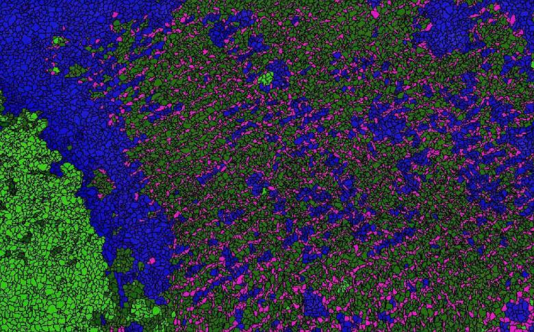
Yield estimates and yield gap analysis are important for identifying poor agricultural productivity. Remote sensing holds great promise for measuring yield and thus determining yield gaps. Farming systems in sub-Saharan Africa (SSA) are commonly characterized by small field size, intercropping, different crop species with similar phenologies, and sometimes high cloud frequency during the growing season, all of which pose real challenges to remote sensing. Here, an unmanned aerial vehicle (UAV) system based on a quadcopter equipped with two consumer-grade cameras was used for the delineation and classification of maize plants on smallholder farms in Ghana. Object-oriented image classification methods were applied to the imagery, combined with measures of image texture and intensity, hue, and saturation (IHS), in order to achieve delineation. It was found that the inclusion of a near-infrared (NIR) channel and red–green–blue (RGB) spectra, in combination with texture or IHS, increased the classification accuracy for both single and mosaic images to above 94%. Thus, the system proved suitable for delineating and classifying maize using RGB and NIR imagery and calculating the vegetation fraction, an important parameter in producing yield estimates for heterogeneous smallholder farming systems.
Hall, O., Dahlin, S., Marstorp, H., Bustos, M. F. A., Öborn, I., & Jirström, M. (2018). Classification of Maize in Complex Smallholder Farming Systems Using UAV Imagery. Drones, 2(22), 1-8. doi:10.3390/drones2030022
