News Archives:
June 24, 2019
A team of geospatial scientists at ICRISAT, led by Murali Krishna Gumma, successfully developed and implemented a MODIS-based workflow to map major staple crops in Malawi and detect major spatio-temporal changes occurred between 2010/2011 and 2016/2017.

June 24, 2019
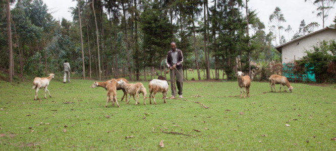
The Supporting Evidence-based Interventions (SEBI) initiative, based at the University of Edinburgh, aims to boost the livelihoods of smallholder farmers by delivering evidence-based technologies and interventions that offer sustainable solutions to the livestock production challenges they face.
This article was originally posted on the Livestock Data for Decisions website | Read articleMay 31, 2019
A recently published study co-authored by Andy Nelson from University of Twente/ITC and Alice Laborte and Nasreen Islam Khan from IRRI, used the multi-temporal Sentil-1 intensity data to discriminate rice establishment methods.
May 30, 2019
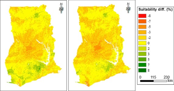
Nicole Lefore from IWMI co-authored a study evaluating the potential climate change effects on the land suitability for groundwater irrigation in Ghana.
May 29, 2019
By spatially disaggregating subnational production statistics data, IFPRI‘s MapSPAM provides high-resolution global maps of 42 crops.