Pixelating Crop Production Statistics: Inside of MapSPAM
Abstract
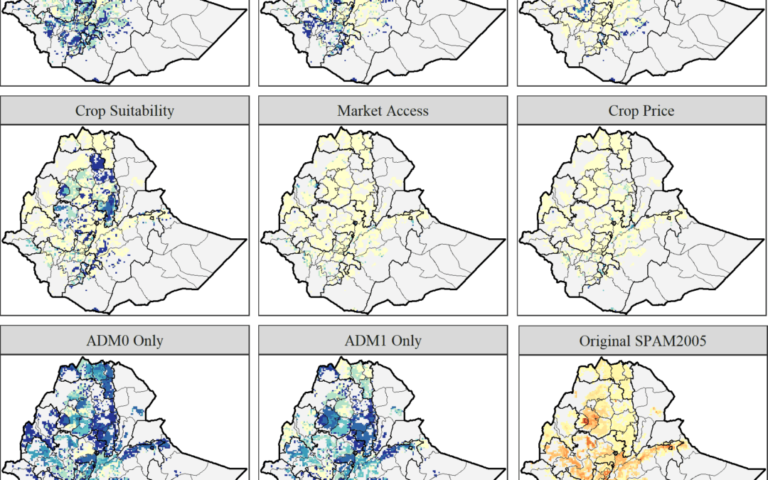
Worldwide, crop production is intrinsically intertwined with biological, environmental and economic systems, all of which involve complex, inter-related and spatially-sensitive phenomena. Thus knowing the location of agriculture matters much for a host of reasons. There are several widely cited attempts to model the spatial pattern of crop production worldwide, not least by pixelating crop production statistics originally reported on an areal (administrative boundary) basis. However, these modeled measures have had little scrutiny regarding the robustness of their results to alternative data and modeling choices. Our research casts a critical eye over the nature and empirical plausibility of these types of datasets. To do so, we determine the sensitivity of the 2005 variant of the spatial production allocation model data series (SPAM2005) to eight methodological-cum-data choices in nine agriculturally-large and developmentally-variable countries: Brazil, China, Ethiopia, France, India, Indonesia, Nigeria, Turkey and the United States. We compare the original published estimates with those obtained from a series of robustness tests using various aggregations of the pixelized spatial production indicators (specifically, commodity-specific harvested area, production quantity and yield). Spatial similarity is empirically assessed using a pixel-level spatial similarity index (SSI). We find that the SPAM2005 estimates are most dependent on the degree of disaggregation of the underlying national and subnational production statistics. The results are also somewhat sensitive to the use of a simple spatial allocation method based solely on cropland proportions versus a cross-entropy allocation method, as well as the set of crops or crop aggregates being modeled, and are least sensitive to the inclusion of crude economic elements. Finally, we assess the spatial concordance between the SPAM2005 estimates of the area harvested of major crops in the United States and pixelated measures derived from remote-sensed data.
Joglekar, A.K., Wood-Sichra, U. and Pardey, P.G., 2019. Pixelating crop production: Consequences of methodological choices. PloS one, 14(2), p.e0212281.
May 29, 2019
CGIAR-CSI

