How the data revolution could help design better agronomic investments
Researchers are using data and tools to produce information that can help farmers, research institutions and governments take better decisions on agronomic practices and investments.
Every farmer faces constraints related to weather uncertainty, soil fertility management challenges, or access to finance and markets. What fertilizer application will give the best returns? What maize crop variety should I plant?
To improve farmers’ yields and incomes, African smallholder farmers need agronomic advice adapted to their specific circumstances. The challenge is even greater in sub-Saharan Africa, where agricultural production landscapes are highly diverse. Yet traditional agronomic research was not designed to fit with complex agroecological regions and farming systems. Compounding the problem, research organizations often have limited resources to develop the necessary experiments to generate farm- and site-specific agronomic advice at scale.
The TAMASA Project
The Taking Maize Agronomy to Scale in Africa (TAMASA) project, funded by the Bill & Melinda Gates Foundation, has used data to improve the way agronomic research for development is done. Researchers working on the TAMASA project addressed this challenge by using available geospatial information and other big data resources, along with new data science tools such as machine learning and Microsoft’s AI for Earth. They were able to produce and package information that can help farmers, research institutions and governments take better decisions on what agronomic practices and investments will give them the best returns.
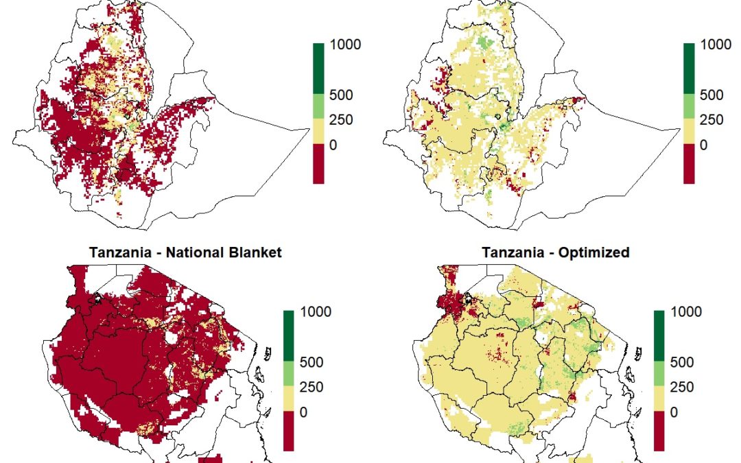
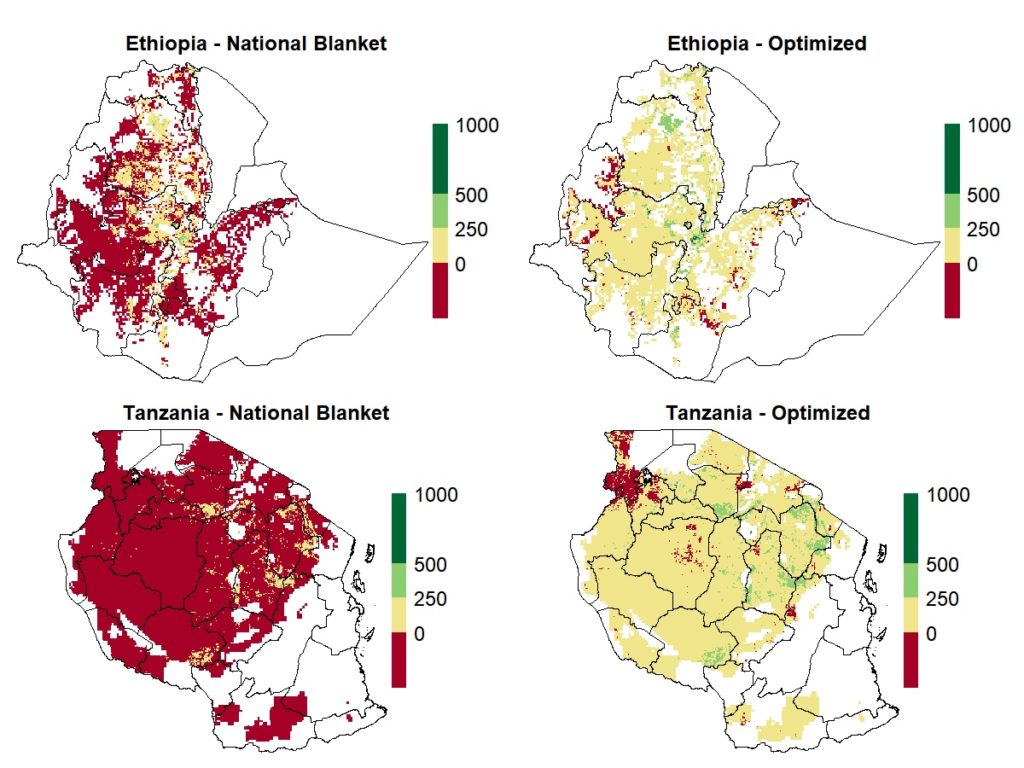
By adapting the Quantitative Evaluation of the Fertility of Tropical Soils (QUEFTS) model to the conditions of small farmers in TAMASA target countries (Ethiopia, Nigeria and Tanzania), using different layers of information, CIMMYT and its partners have developed a versatile geospatial tool for evaluating crop yield responses to fertilizer applications in different areas of a given country. Because calculations integrate spatial variation of fertilizer and grain prices, the tool evaluates the profitability — a key factor influencing farmers’ fertilizer usage — for each location. The project team can generate maps that show, for instance, the estimated agronomic and economic returns to different fertilizer application scenarios.
April 2, 2019
Jérôme Bossuet
International Wheat and Maize Improvement Center
Mexico City, Mexico
Latest news

