News Archives:

May 26, 2020
Webinar organized by the Crop Modeling and Geospatial Data Communities of Practice of the CGIAR Platform for Big Data in Agriculture.
May 11, 2020
The COVID-19 global pandemic resulted in a precautionary measures in several countries that inevitably affected agri-food systems, its allied industries and livelihoods of workers and communities alike. Initially, there were no available data to accurately assess COVID-19 impact on the agricultural sector, livelihoods and environment. While country-wide lockdowns were necessary measures, they brought the agricultural […]
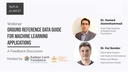
April 22, 2020
A webinar organized by Our Radiant Earth Foundation and the Geospatial Data Community of Practice of the CGIAR Platform for Big Data in Agriculture.
April 22, 2020
Webinar organized by the Radiant Earth Foundation and the CGIAR Platform for Big Data in Agriculture.
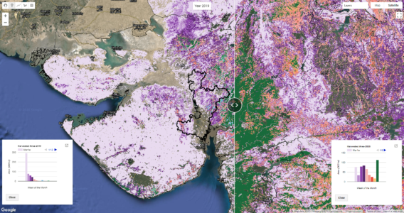
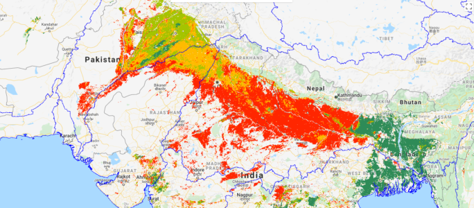
April 17, 2020
This blog post was written by Giriraj Amarnath, Surajit Ghosh, and Carolyn Fry at the International Water Management Institute and first published at Thrive by CGIAR Research Program on Water, Land, and Ecosystem. Take a look at the satellite map below. That vast swathe of orange and red across northwestern India and Pakistan depicts crops […]
April 16, 2020
The Digital Soil Mapping (DSM) is a data-driven technique that creates and populates spatial soil information systems by coupling field-measurements with spatial and non-spatial soil inference systems. In Africa, for example, the Africa Soil Information Service (AfSIS) project used the DSM approach to generate a great variety of soil property maps for the entire African […]