News Archives:

July 24, 2020
CHIR Explorer is a web-based tool for visualizing high-resolution time-series precipitation data. Read about its sources and uses.
July 21, 2020
The fourth episode of our Discussion Series: Big data solutions to COVID-19 & food security, brought together four panelists to discuss bridging gaps and building resiliency with digital agriculture platforms.
July 16, 2020
Once again, our community joined the Esri User Conference 2020, the world’s largest virtual GIS event with more than 80,000 online attendees. As we did in previous years, we hosted a “virtual” booth in the conference’s Sustainable World Expo section, along with many other organizations that use geospatial data and analysis toward achieving SDGs. This […]
July 15, 2020
As Covid-19 continues to disrupt food distribution systems, it is not only critical to ensure that supply chains continue to function, but also to assess how to emerge stronger from the crisis.
July 14, 2020
The third episode of our Discussion Series: Big data solutions to COVID-19 & food security, brought together four panelists to discuss tools for agile adaptation regarding digital extension and agricultural advisories.
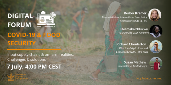
July 7, 2020
The second episode of our Discussion Series: Big data solutions to COVID-19 & food security, brought together four panelists to discuss challenges and solutions to input supply chains and on-farm realities.