CHIR Explorer: An Online Tool for Assessing Dry and Wet Conditions

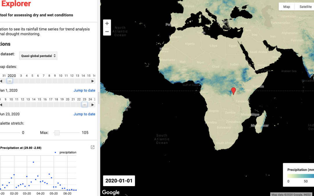
A screenshot of the CHIR Explorer interface visualizing the time-series rainfall in Western Kenya. Source: https://egiron.users.earthengine.app/view/chir-explorer
Estimating rainfall variations in space and time is a key aspect of drought early warning and environmental monitoring. This is especially important in areas where surface station data is sparse.
CHIR Explorer is a web-based tool developed by Ernesto Giron (CIMMYT). Built on Google Earth Engine, the CHIR Explorer tool visualizes high-resolution time-series precipitation data from CHIRPS for analyzing rainfall trends and monitoring seasonal drought without downloading or installing any software.
The underlying climate dataset, CHIRPS, is developed by the Climate Hazards Center at the University of California at Santa Barbara. This dataset is quasi-global (50S-50N), gridded (~5km or 0.05 degree resolution), covering the period from 1981 to current. For more details, please see Funk et al. 2015.
July 24, 2020
CGIAR-CSI

