Geospatial Analyses at CGIAR Centers/Alliances
Have you ever wondered what kinds of geospatial analysis being done in CGIAR? You’ve come to the right place! CGIAR-CSI connects +500 researchers who apply spatial data and analysis in agricultural research and development work across all Centers/Alliances. Our community members actively engage with each other to share ideas, collaborate on new projects, or ask for help to find data. Not everything they do formally get packaged and published, so we continue finding this informal peer-to-peer engagement is important in many ways.
At the 2020 Community Meeting in March, we asked the CSI Center Representatives to give a quick presentation to update the community with what new geospatial data and analysis they are developing. The presentations were online streamed during the meeting, but in case you missed it, below is the list of presentations they gave.
Of course, there is a lot more going on all the time! Feel free to reach out to the presenter if you’re interested in learning more.
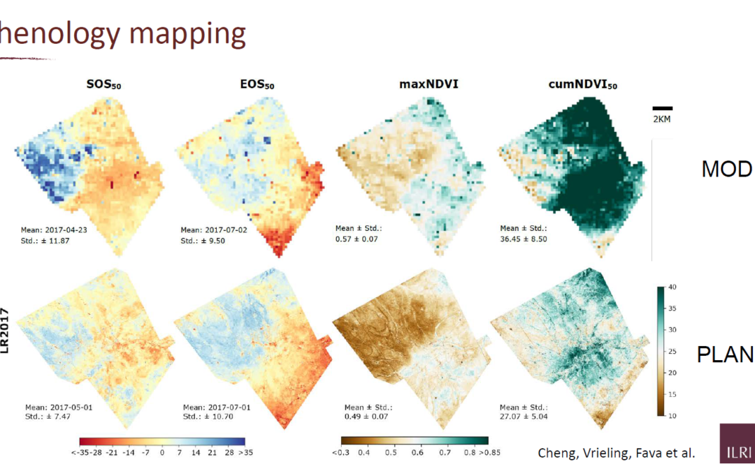
Cover image credit: “Phenology Mapping using MODIS and Planet” by Cheng, Vrieling, Fava et al. (ILRI)
October 14, 2020
CGIAR-CSI

