Mapping Crop Types using Sentinel-2 Satellite Data
Abstract
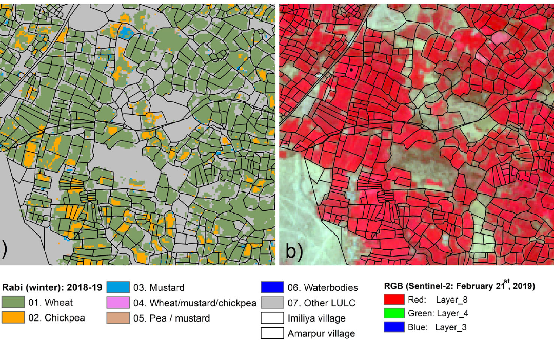
Accurate monitoring of croplands helps in making decisions (for insurance claims, crop management and contingency plans) at the macro-level, especially in drylands where variability in cropping is very high owing to erratic weather conditions. Dryland cereals and grain legumes are key to ensuring the food and nutritional security of a large number of vulnerable populations living in the drylands. Reliable information on area cultivated to such crops forms part of the national accounting of food production and supply in many Asian countries, many of which are employing remote sensing tools to improve the accuracy of assessments of cultivated areas. This paper assesses the capabilities and limitations of mapping cultivated areas in the Rabi (winter) season and corresponding cropping patterns in three districts characterized by small-plot agriculture. The study used Sentinel-2 Normalized Difference Vegetation Index (NDVI) 15-day time-series at 10 m resolution by employing a Spectral Matching Technique (SMT) approach. The use of SMT is based on the well-studied relationship between temporal NDVI signatures and crop phenology. The rabi season in India, dominated by non-rainy days, is best suited for the application of this method, as persistent cloud cover will hamper the availability of images necessary to generate clearly differentiating temporal signatures. Our study showed that the temporal signatures of wheat, chickpea and mustard are easily distinguishable, enabling an overall accuracy of 84%, with wheat and mustard achieving 86% and 94% accuracies, respectively. The most significant misclassifications were in irrigated areas for mustard and wheat, in small-plot mustard fields covered by trees and in fragmented chickpea areas. A comparison of district-wise national crop statistics and those obtained from this study revealed a correlation of 96%.
Murali Krishna Gumma , Kimeera Tummala , Sreenath Dixit , Francesco Collivignarelli , Francesco Holecz , Rao N. Kolli & Anthony M. Whitbread (2020): Crop type identification and spatial mapping using Sentinel-2 satellite data with focus on field-level information, Geocarto International
August 27, 2020
CGIAR-CSI

